Selecciona tu idioma
Select your preferred language
Inteligencia Territorial
El agua fluye.
Tus datos también.
Somos el primer especialista GIS en agua de la industria. Transformamos el caos de datos —ya provengan de un dron submarino, un sensor LoRaWAN o un tomador en terreno— en un ecosistema auditable y vivo.
Reunámonos →

La tecnología sin visión humana, es solo ruido.
El agua es una sola. Un dato puede ser obtenido por un dron submarino, por un vuelo fotogramétrico, por un operario usando ArcGIS, o incluso por un WhatsApp.
Ya sea que estemos resolviendo el dolor urbano de las sanitarias o el dolor rural en APRs, el pilar de nuestra implementación es siempre el factor humano. Hacemos que la tecnología más compleja se convierta en control real para las personas.
Líderes de la Industria Territorial
Referentes técnicos que han construido las infraestructuras de datos espaciales e hídricas más críticas de Chile durante las últimas décadas.
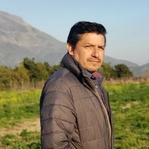
David Barra
CEOImpulsando el crecimiento hacia el mundo rural, hidráulico y telemetría IoT, bajo la visión de que la alta tecnología debe estar disponible para todos los chilenos.
Trayectoria:
- Director SNAP: Levantamiento de procesos, telemetría y facturación para SSR.
- Fuerza Aérea de Chile (27 años): Ex Director de TI del SAF.
- Aguas Andinas (14 años): Asesor Superior TI.

Etienne Araya
Socio FundadorCon más de 17 años de trayectoria, es un visionario técnico en el desarrollo de aplicaciones WEB GIS, control logístico y plataformas de alto impacto nacional.
Trayectoria:
- SmartReport App (9 años): Co-Founder.
- Esri-Chile (3 años): Jefe de Proyectos.
- Tastets System S.A.: Gerente de Tecnología.

Nuestro Ecosistema de Productos
Desarrollamos plataformas propietarias de alto impacto y usabilidad.
SNAP GIS
Sistema Nacional de Agua Potable y APRs. Gestión inteligente y digitalización desde cero para el mundo rural.

SmartReport
Herramienta integral para el control logístico y gestión avanzada de activos móviles en terreno.

CiudadGIS
Plataforma colaborativa en la nube para la gestión territorial y direcciones municipales.
Cada eslabón de la cadena hídrica.
Despliega cada sección para descubrir cómo unificamos hardware, software, territorio y comunidad en una sola visión estratégica.
01. Software Administrativo para Sanitarias y APRs
02. Sistema GIS y Soluciones en Terreno
03. Trazabilidad de Procesos Sanitarios
04. Medidores Remotos e Inteligencia IoT
05. Tecnología LoRaWAN y Telemetría a Medida
06. Control de Pérdidas (NRW) y DMA
07. Desarrollo de Software (From Scratch)
08. Restitución Fotogramétrica y Captura Avanzada
09. Digitalización Rural (Sistema SNAP)
10. Visión Humana y Mediación Antropológica
11. Capacitaciones y Vínculos Privado-Comunitarios
Catálogo Exhaustivo de Proyectos
Explora el desglose completo de nuestras implementaciones para la defensa nacional, corporaciones sanitarias, ministerios y municipalidades a lo largo de Chile.
 Enel Latinoamérica
Soporte de Alto Nivel y Outsourcing a Utilities
Soporte de Alto Nivel y Outsourcing a Utilities
Caso de Éxito Internacional
A través de nuestros partners internacionales, Enel optó por Geoxite para fortalecer sus servicios de apoyo avanzado en Chile, Colombia, Brasil, Argentina y Perú. Movilizamos a un equipo de ingenieros para brindar soporte a la infraestructura WFM y manejar problemáticas de alta incidencia.
 Fuerza Aérea de Chile (FACH)
Licitación del Proyecto Satelital Chileno
Licitación del Proyecto Satelital Chileno
Geoxite fue reconocido oficialmente al adjudicarse la Mejor Nota Técnica en la licitación para la modernización y soporte del Proyecto Espacial y Satelital Chileno (SNSat). Nuestra propuesta garantizó los más altos estándares de procesamiento espacial.
 Aguas Andinas
Digitalización Inteligente Agua Potable y Servidas
Digitalización Inteligente Agua Potable y Servidas
Creación de un add-in avanzado para la digitalización inteligente con estrictas reglas topológicas y de negocio. Se garantizó la consistencia de los sistemas SAP, Facturación, Siebel y Aquasis, re-ubicando a más de 1 millón de clientes.
 Fuerza Aérea de Chile (SAF)
Soporte y Creación de Plataforma IDE y App Móvil
Soporte y Creación de Plataforma IDE y App Móvil
Desarrollo integral de un portal de Infraestructura de Datos Espaciales (IDE) y un aplicativo móvil para toma de datos en vuelo (FLYSAFE). La plataforma disponibiliza información geoespacial a nivel nacional.
 Municipios de Paine y Coronel
Sistema Información Territorial (CIUDADGIS)
Sistema Información Territorial (CIUDADGIS)
Implementación en la nube de la suite CiudadGIS (+30 apps) para gestionar catastro de señaléticas, turismo, SECPLA y certificados DOM en línea.
 Ministerio Medio Ambiente / SEA
Sistemas SINIA, Humedales y SIG-SEA
Sistemas SINIA, Humedales y SIG-SEA
Estructuración de la Infraestructura de Datos Espaciales corporativa. Desarrollo del Inventario Nacional de Humedales y soporte crítico al sistema SIG-SEA para evaluaciones de impacto ambiental.
 Sernageomin & Forestal Arauco
Catastro Minero On-Line y Producción Forestal
Catastro Minero On-Line y Producción Forestal
Modelamiento de la Geodatabase de propiedades mineras. Interfaz web para consultar permisos de Exploración/Explotación. En el sector forestal, software para planificar operaciones, faenas de cosecha y raleo.
 EFE (Trenes de Chile)
Soporte a Infraestructura ArcGIS
Soporte a Infraestructura ArcGIS
Asesores expertos en información geoespacial. Prestamos soporte directo y especializado a la infraestructura ArcGIS de EFE, garantizando la operatividad de los datos espaciales para la red de trenes de Chile.
Nuestros datos respaldan al país.
Desde la principal sanitaria del país hasta la Fuerza Aérea de Chile, actores fundamentales confían en Geoxite para administrar y convertir datos territoriales en decisiones críticas.
Ubicando tus decisiones.
No importa si su dolor está en la captura topográfica con drones, en la telemetría LoRaWAN, o en la mediación con la comunidad. Tenemos la ingeniería y la humanidad para resolverlo.
Agendar Diagnóstico →
Territorial Intelligence
Water flows.
Your data does too.
We are the first GIS water specialist in the industry. We transform data chaos—whether from an underwater drone, a LoRaWAN sensor, or a field operator—into an auditable and living ecosystem.
Let's Meet →
Technology without human vision is just noise.
Water is one. A data point can be obtained by an underwater drone, a photogrammetric flight, an operator using ArcGIS, or even via WhatsApp.
Whether we are solving the urban pain of large utilities or the rural pain in APRs, the pillar of our implementation is always the human factor. We turn complex technology into real control for people.
Territorial Industry Leaders
Technical benchmarks who have built Chile's most critical spatial and water data infrastructures over the last decades.
David Barra
CEODriving growth towards the rural, hydraulic, and IoT telemetry world, under the vision that high technology must be available to everyone.
Background:
- SNAP Director: Process mapping, telemetry, and billing for rural systems.
- Chilean Air Force (27 years): Former IT Director of SAF.
- Aguas Andinas (14 years): Senior IT Advisor.
Etienne Araya
Founding PartnerWith over 17 years of experience, a technical visionary in WEB GIS application development, logistics control, and high-impact national platforms.
Background:
- SmartReport App (9 years): Co-Founder.
- Esri-Chile (3 years): Project Manager.
- Tastets System S.A.: Technology Manager.
Our Product Ecosystem
We develop high-impact, user-friendly proprietary platforms.
SNAP GIS
National Rural Water System. Smart management and digitization from scratch for the rural world.
SmartReport
Comprehensive tool for logistics control and advanced field mobile asset management.
CiudadGIS
Cloud collaborative platform for territorial and municipal address management.
Every link in the water chain.
Unfold each section to discover how we unify hardware, software, territory, and community.
01. Administrative Software for Utilities & Rural Water
02. GIS Systems and Field Solutions
03. Utility Process Traceability
04. Remote Meters and IoT Intelligence
05. LoRaWAN Technology and Custom Telemetry
06. Non-Revenue Water (NRW) Control & DMA
07. Custom Software Development (From Scratch)
08. Photogrammetric Restitution and Advanced Capture
09. Rural Digitization (SNAP System)
10. Human Vision and Anthropological Mediation
11. Training and Private-Community Ties
Exhaustive Project Catalog
Explore the complete breakdown of our implementations for national defense, utilities, ministries, and municipalities across Chile.
Enel Latin AmericaHigh-Level Support and Outsourcing for Utilities
High-Level Support and Outsourcing for Utilities
Through our international partners, Enel chose Geoxite to strengthen its advanced support services in Chile, Colombia, Brazil, Argentina, and Peru. We mobilized a team of engineers to support the WFM infrastructure and handle high-incidence issues.
Chilean Air Force (FACH)Chilean Satellite Project Bidding
Chilean Satellite Project Bidding
Geoxite was officially recognized by securing the Best Technical Score in the demanding bid for the modernization and support of the Chilean Space and Satellite Project (SNSat).
Aguas AndinasSmart Digitization of Drinking & Wastewater
Smart Digitization of Drinking & Wastewater
Creation of an advanced add-in for smart digitization with strict topological and business rules. Ensuring consistency across SAP, Billing, and Aquasis systems, relocating over 1 million customers.
Chilean Air Force (SAF)SDI Platform and Mobile App Creation
SDI Platform and Mobile App Creation
Comprehensive development of a Spatial Data Infrastructure (SDI) portal and a mobile application for in-flight data collection (FLYSAFE). The platform provides national-level geospatial info.
Municipalities of Paine & CoronelTerritorial Information System (CIUDADGIS)
Territorial Information System (CIUDADGIS)
Cloud implementation of the CiudadGIS suite (+30 apps) to manage signage cadastre, tourism, SECPLA, and online DOM certificates.
Ministry of Environment / SEASINIA Systems, Wetlands, and SIG-SEA
SINIA Systems, Wetlands, and SIG-SEA
Structuring the corporate Spatial Data Infrastructure. Development of the National Wetland Inventory and critical support for the SIG-SEA system for environmental impact assessments.
Sernageomin & Forestal AraucoOnline Mining Cadastre & Forest Production
Online Mining Cadastre & Forest Production
Modeling the mining properties Geodatabase. In the forestry sector, corporate software to plan operations, harvesting, and thinning.
EFE (Chilean Trains)ArcGIS Infrastructure Support
ArcGIS Infrastructure Support
Geospatial information expert advisors. We provide direct and specialized support to EFE's ArcGIS infrastructure, guaranteeing spatial data operability for the Chilean train network.
Our data supports the country.
From the country's main water utility to the Chilean Air Force, fundamental players trust Geoxite to manage and convert spatial data into critical decisions.
Locating your decisions.
Whether your pain is in drone topographic capture, LoRaWAN telemetry, or community mediation, we have the engineering and humanity to solve it.
Book a Diagnostic →